Inclinometer Surveys
Southern Geophysical's inclinometer surveys offer accurate 3D borehole representation, providing reliable data with versatile delivery options
Other names: Borehole inclination survey, wellbore trajectory, borehole deviation, borehole drift and verticality surveys.
Inclinometer Survey
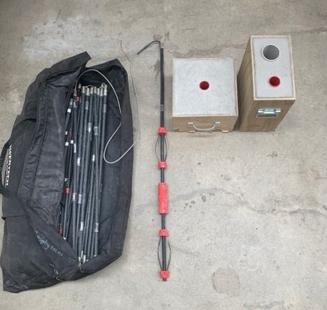
Southern Geophysical offer inclinometer surveys as a component of borehole surveys. With three orthogonal inclinometer sensors and pre and post survey calibration, the inclinometer can produce an accurate 3D representation of the path of a borehole.
The use of a push rod system allows the inclinometer to be used in any borehole (vertical/horizontal or inclined), and with the sensor package being waterproof the inclinometer is usable in water filled or unfilled boreholes.
The sensor is calibrated and tested within a controlled environment, providing reliable and reproducible results.
Our inclination surveys provide you with a CSV file containing the inclination of a borehole and/or the offsets between multiple boreholes. We also provide 3D and 2D visual representations of the borehole path. Other delivery formats are available on request.
Inclinometer Survey Specifications
Instrument Accuracy: | ||
|---|---|---|
X axis | +/- 0.05˚ | |
Y axis | +/- 0.05˚ | |
Z axis | +/- 1.00˚ |
Instrument Applications: | ||
|---|---|---|
Range | 27 m +* | |
Borehole Diameter | Adjustable |
*Push system to 27 m. This range can be increased using a rod extension system.