Landfill Investigations
New Zealand has a complex history of waste disposal to landfill, with many landfills located near eroding riverbanks or within urban developments and of unknown sizes and extents
With this in mind, Southern Geophysical provide a multi-faceted approach to landfill surveying to satisfy the needs of councils, environmental scientists and local Iwi. Our most common survey methods are outlined below:
Ground Penetrating Radar (GPR)
GPR is a staple survey of landfill investigations. GPR has the highest resolution of all the geophysical survey methods and kilometers of radar lines can be captured in a day. A grid of GPR lines can identify the extents of most landfills by locating objects in the subsurface, or alteration of the natural sedimentary layers.
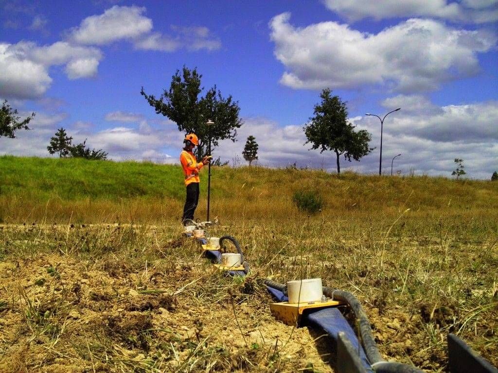
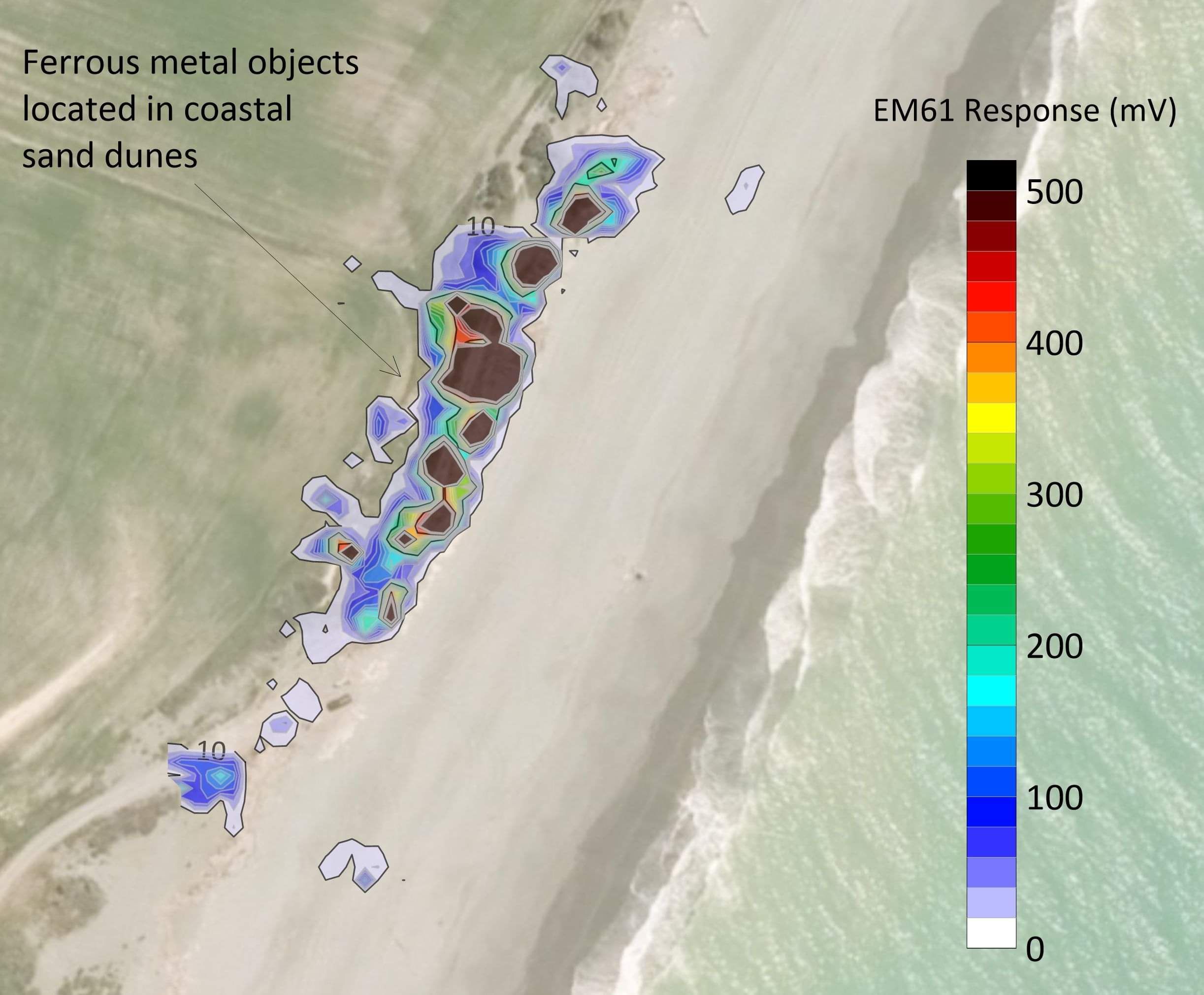
GPS synced precision metal detection (EM61)
EM61 can be extremely useful in clearly defining the extents of ferrous metal landfill materials when they are within the upper two metres of the subsurface. With the position of the unit captured in real time, surveying is not only quick but extremely accurate.
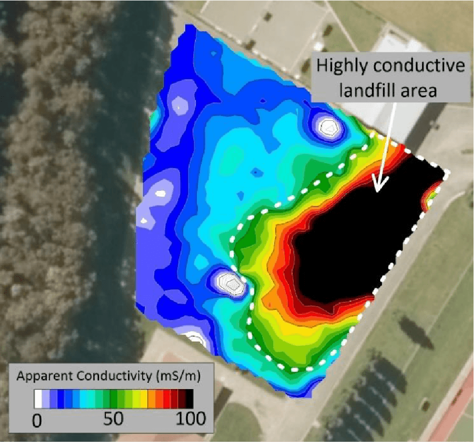
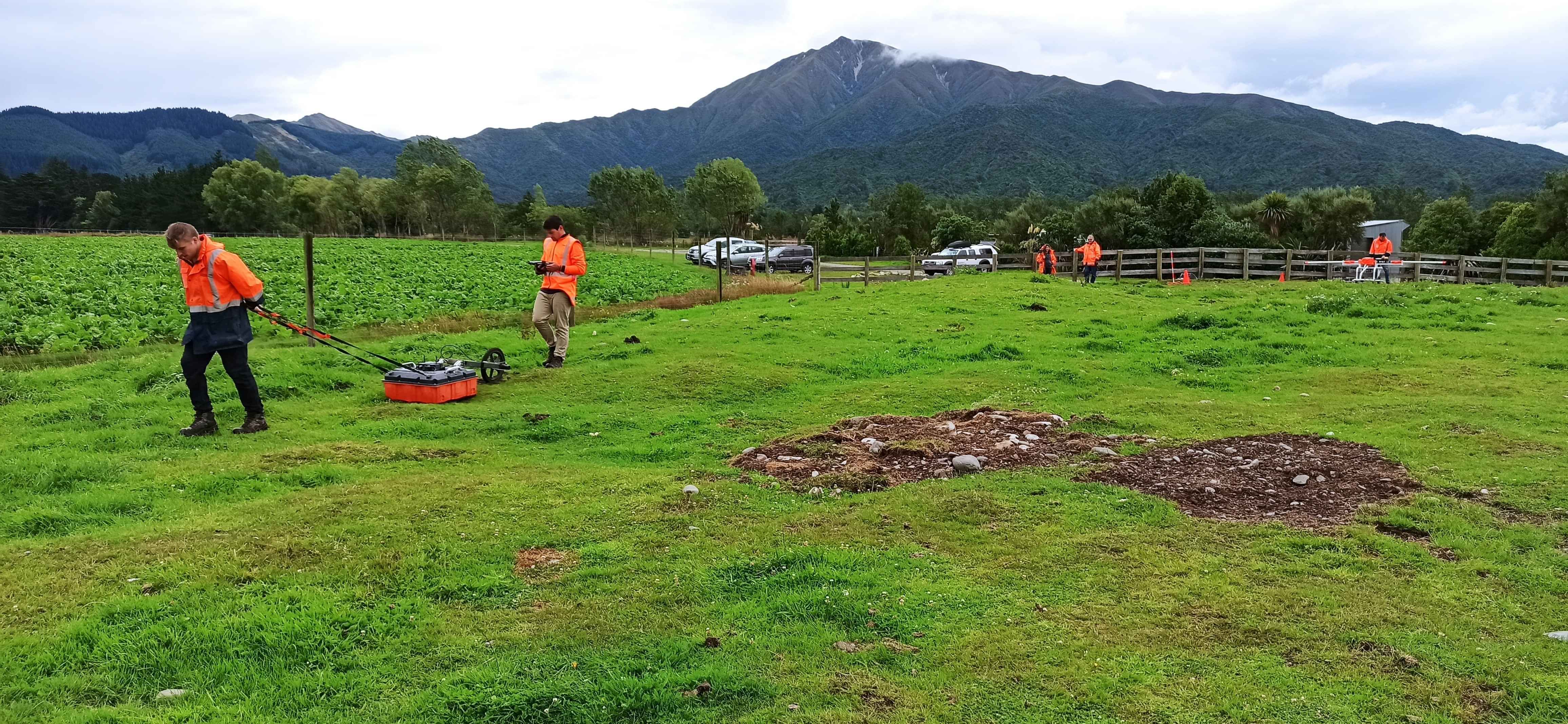
Ground Conductivity (EM31)
EM31 surveying is a quick and cost-effective way of locating a landfill by identifying conductivity changes in the subsurface, down to a depth of six metres. The system also runs as a broad metal detector which is particularly useful when ferrous metals are known to have been buried. A grid of survey lines can delineate the extents of many types of landfills as the conductivity of landfill materials and leachate can differ significantly from that of the surrounding natural ground.
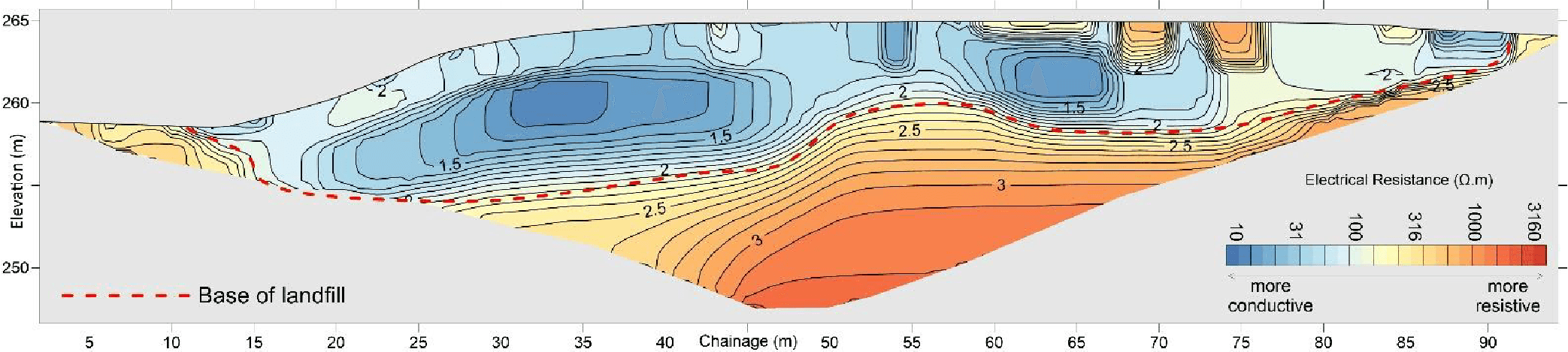
Electrical Resistivity Tomography (ERT)
ERT can identify the vertical extents of a landfill by identifying differences in the electrical properties of the ground. Landfill deposits typically give chaotic results, with a mix of highly resistive and highly conductive materials. We typically run an ERT survey as two to four perpendicular lines, depending on the size of the site.
Seismic P-S wave Reflection and Refraction
Seismic surveying can be used to identify the vertical extents of a landfill. The survey works by transmitting acoustic impulses into the ground. When the impulse encounter significant changes in the subsurface, such as landfill deposits or sedimentary structures, some of the impulses are reflected/refracted back to the surface. The intensity and arrival time of the returning impulses are captured by an array of geophones, and the data is combined to produce a 2D cross section.
Multi-channel Analysis of Surface Waves (MASW)
MASW can also be used to identify the vertical extents of a landfill. However, MASW only works in well consolidated landfill materials. MASW works by dropping or accelerating a heavy weight onto the ground surface, generating surface waves. The surface waves propagate outwards from the source, towards a string of geophones on the ground surface and the frequency and velocity of the waves can be used to develop a shear wave velocity model of the subsurface. The shear wave velocities directly correlate to stiffness of the ground and the stiffness of landfill material typically differs significantly from that of natural ground. MASW results can also be used for seismic site classification or liquefaction analysis.