Utility Mapping
Southern Geophysical pioneered 3D utility mapping in
New Zealand.
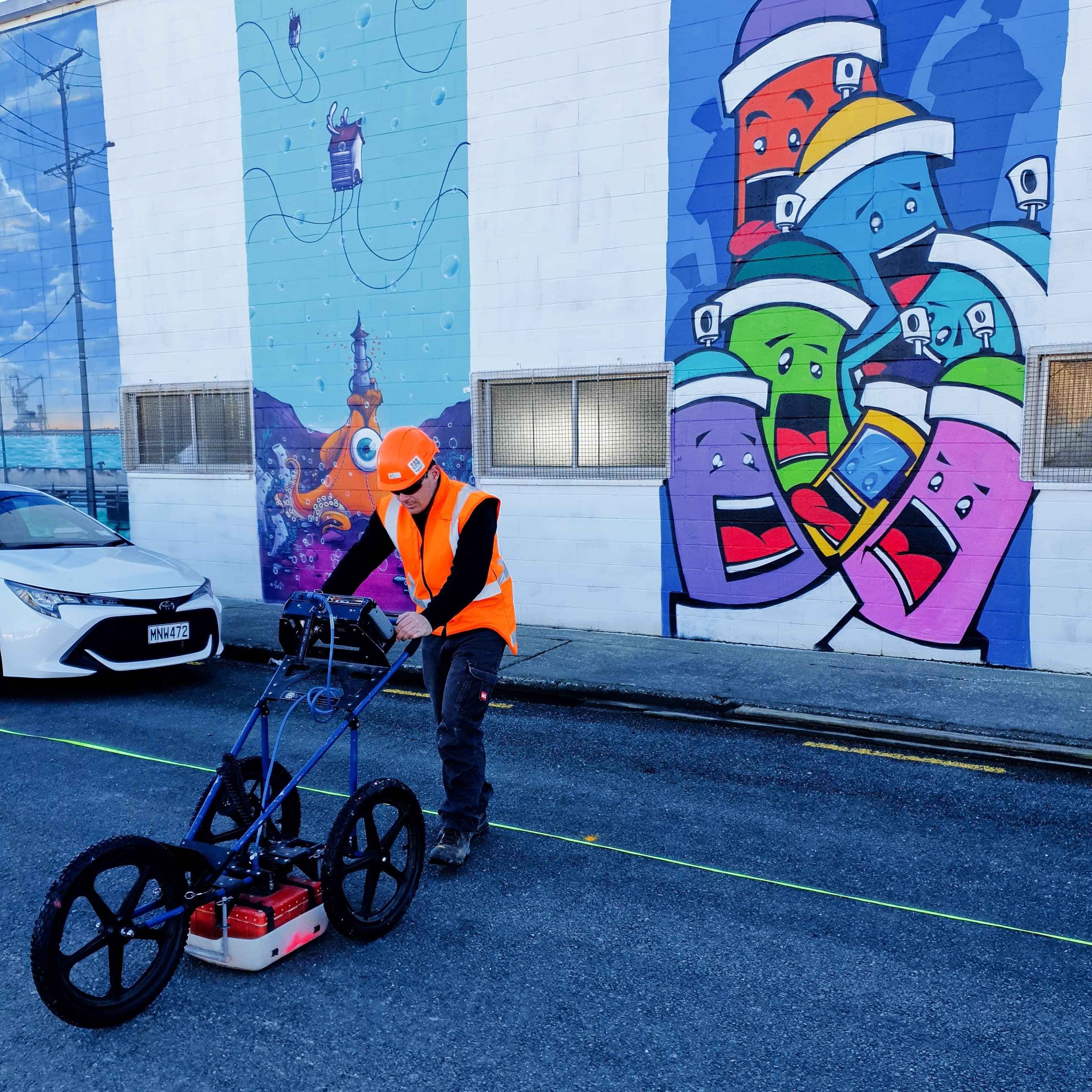
Over the last 20 years locating underground services has been a continually growing requirement. From the “early” days where basic radar systems and electromagnetic locators were used to find pipes and cables, utility locating has grown to now include 3D mapping of the subsurface and incorporation into CAD and GIS systems. Southern Geophysical has always been at the forefront of utility detection and location science. With the latest radar systems, locator and GNSS technology. We have also invested heavily in the latest 3D analysis software and research.
A few of our areas of expertise are:
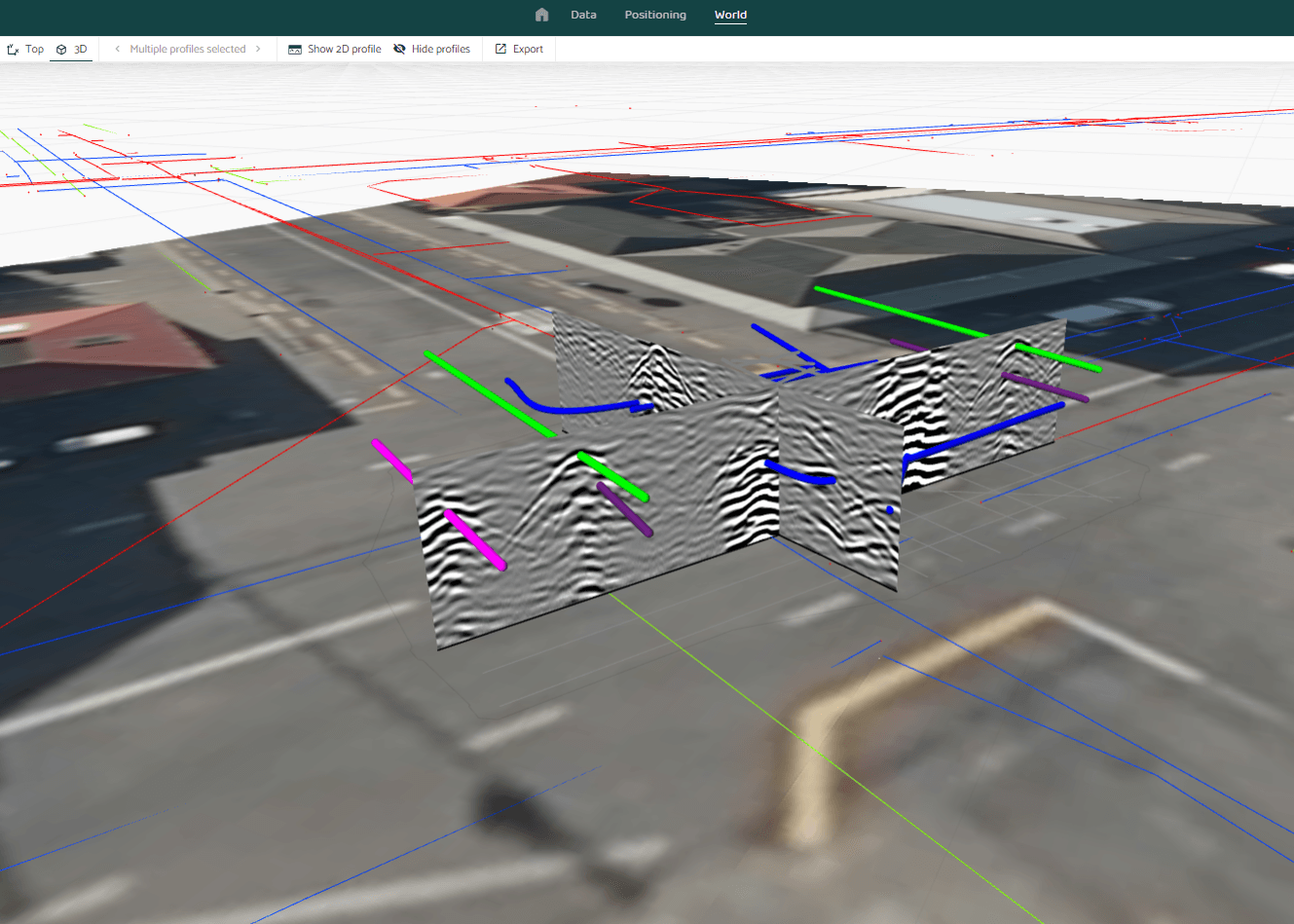
2D and 3D Mapping
We produce detailed, accurate, 3D CAD, GIS, as-builts, aerial imagery overlays and cost-effective pricing. These maps show pipes and utility paths in 3D space and variable depths. This allows areas of complex below ground infrastructure to be understood, modelled and changes to alignments additions made. Our staff are all science degree or higher qualified so understand this scientific method.
We have produced utility detection maps for hundreds of large industrial projects including milk factories/ alumium foundries, large road projects, ports, hospitals and water treatment plants.
Deep Utility Surveys
With the backup of a large geophysics team and world-class methods we can undertake the types of survey at depths and in locations basic utility locators are unable to. We have a range of electromagnetic systems which can detect utilities at depths beyond the range of simple cart locator radar systems. We have radar system which can reach depths of > 20m. We also offer seismic survey technology which can detect utilities at depths and in locations (clayey soils) were radar is not useable.
An example survey we have undertaken is locating large water pipe 5m below clay rich soils in the Bay of Plenty.
Risk Identification and Classification
We can help reduce risk by defining what is known once a survey is complete and what is not known. Utility detection and mapping has inherent limitations which should be clearly defined along with any maps or reports generated.


